
Danube waterway
This section of Danube Logistical Information provides useful information about the Danube Waterway in one place. Here you can find information about the following:
- Bridge clearances
- Gabčíkovo Waterworks
- Upgrade of Gabčíkovo Locks, a project financed through European Union funding
- Water level on the Slovak section of Danube river
- Standardised navigational measures
- Weather
- Vessel dimension limits
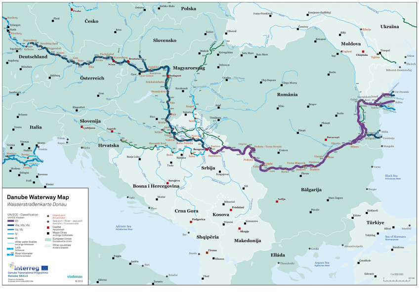
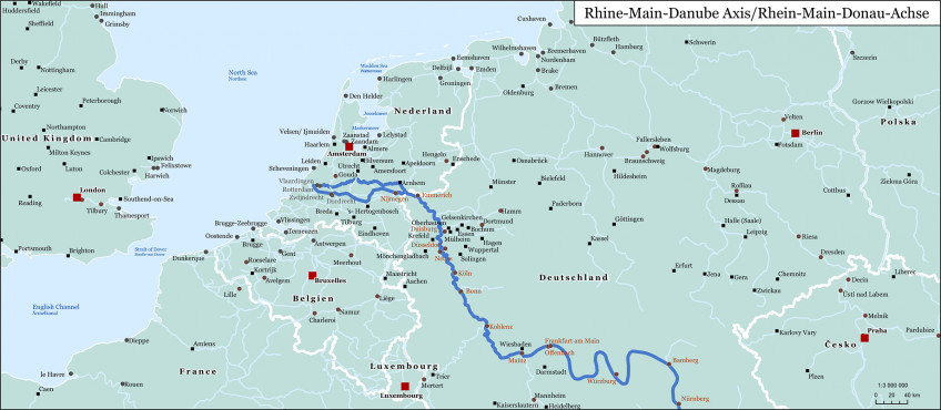
The Danube is the second longest river in Europe, flowing through a number of countries in central and south-eastern Europe. In terms of navigation, it is one of the Europe's most important inland waterways. Since 1992, when the Danube-Main Canal was opened at the watershed above Nuremburg, freight and passenger traffic has been able to ply on pushed convoys of vessels or motorboats between the countries along the Danube River and also in Western Europe.
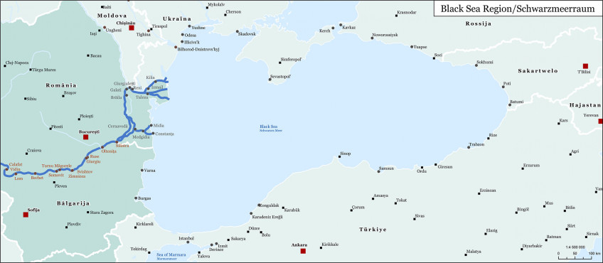
The Danube River is part of the transcontinental waterway joining the North Sea and the Black Sea. It has been designated as Corridor VII, indicated as E 80 under the European Agreement on Main Inland Waterways of International Importance (AGN), while belonging to Slovakia’s transport infrastructure as part of the trans-European transport network (TEN-T).
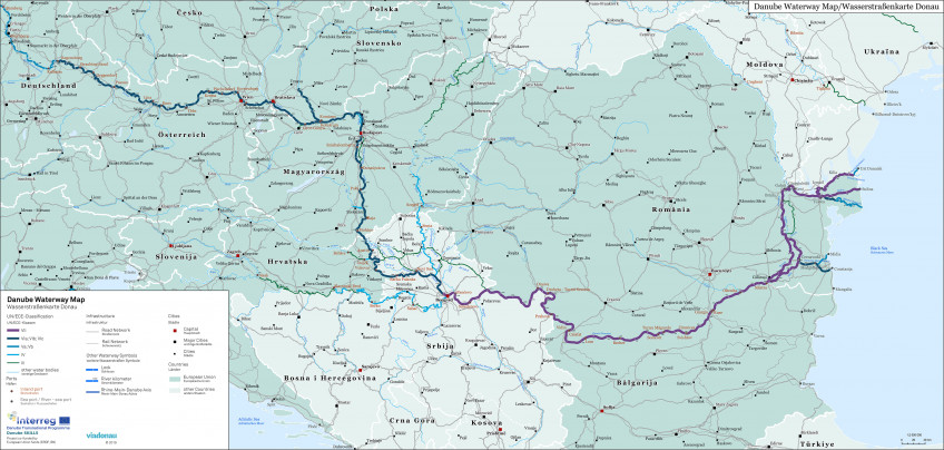
Even with respect to Slovakia’s geographic position in Central Europe, inland navigation within Slovakia is predominantly bound to the Danube waterway. It joins Slovakia to nine European countries (Germany, Austria, Hungary, Croatia, Serbia, Romania, Bulgaria, Moldova and Ukraine), making it a critical water transport pillar for the country. The total navigable length of the Danube for merchant vessels is 2,411 kilometres from the port of Kelheim, Germany to where it empties into the Black Sea, with 172 kilometres flowing through Slovakia between the confluence of the Morava (March) near Devin Castle at kilometre 1,880.26 and the point where the Ipeľ (Ipoly) enters the Danube at kilometre 1,708.20 near Szob, Hungary. This stretch of the Danube is divided into the common border of Slovakia and Austria between kilometres 1,872.70 and 1,880.20 (7.56 km), between 1,850.20 and 1,872.70 (22.5 km) where the river lies entirely within Slovakia, and finally the common border of Slovakia and Hungary between kilometres 1,708.20 and 1,850.20 (142 km). It flows past three of Slovakia's administrative regions – Bratislava, Trnava and Nitra, within which there are three public ports: Bratislava, Komárno and Štúrovo.
Besides the Morava and Ipeľ, the most significant Danube tributaries in Slovakia include the Váh and the Hron rivers. The length of these watercourses and also their catchment areas are shown in Table 1 below.
Table 1: Largest tributaries of the Danube within Slovakia
|
Tributary |
Catchment area [km2 ] |
Length [km] |
|---|---|---|
| Morava * | 2 282 | 108,0 |
| Váh | 18 769 | 407,4 |
| Hron | 5 465 | 278,5 |
| Ipeľ | 3 649 | 212,0 |
Source: Slovak Hydrometeorological Institute * catchment area and length within Slovakia
There are sixteen gauging stations located directly on the Danube’s main flow, of which seven measure flow rates. These are located at Devín, Bratislava, Medveďov, Dobrohošť, Komárno, Iža and Štúrovo. The Bratislava gauging station is the oldest one in Slovakia.
Figure 1: The Danube River in Slovakia
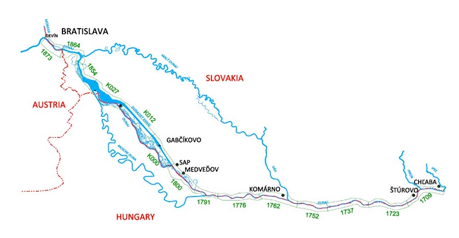
Figure 2: View of the Danube past Štúrovo toward Szob, Hungary
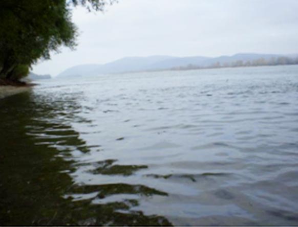
Source: Slovak Hydrometeorological Institute
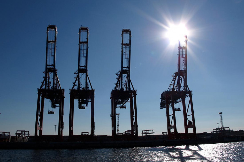
In Slovakia, there are bridges along the Danube connecting the both banks in Štúrovo, Komárno, Medveďov, Gabčíkovo and Bratislava (4 bridges). All the bridges have sufficient clearance for navigation.
Information about the bridges along the Slovakian stretch of the Danube can be found at the following links:
Slovakia's stretch of the Danube waterway includes the Gabčíkovo Waterworks, which was originally designed and constructed to be part of a system of dams and reservoirs on the Danube between Gabčíkovo and Nagymaros, Hungary. Construction of the dam started in accordance with the Budapest Treaty signed in 1977 between Czechoslovakia and Hungary, with the latter country withdrawing from it in 1992. After a substitute solution, called Alternative C, was completed with a slight delay and the Danube was dammed entirely within Slovakia at Čunovo, the waterworks complex was opened in 1992. The primary objectives to be achieved by constructing the waterworks were to improve navigation conditions, flood protection and generation of electricity, although emphasis was also placed on recreational use and tourism. There was also urgency in meeting requirements to secure the fairway at fords. Rapid deepening of the channel caused nearby lakes to dry up. Construction of the Gabčíkovo Waterworks on the Slovak stretch of the Danube greatly satisfied these requirements, eliminating 7 fords, increasing transport speeds, removing a narrow fairway at Bagomer and guaranteeing year-round navigable depths within the entire section as well as at the Port of Bratislava.
Construction of the Gabčíkovo Dam also had favourable environmental and landscape impacts. Prior construction of waterworks at the Danube in Austria had almost completely stopped gravel from flowing down the river, gradually reducing the level of the main channel in Slovakia. The side lakes were fed only when water levels were higher than normal, so most of the year they were half empty and drying up. As the water level in the Danube fell, the groundwater level in the floodplain forests likewise dropped, causing them also to dry up. As the water level continued to fall with the dredging of the channel to maintain navigable depths, both the lakes and the forests on both sides of the Danube were going to inevitably vanish. The opening of the Gabčíkovo Waterworks and filling of the reservoir visibly changed the situation in the half-empty lakes and the Moson Danube. Water returned to the lakes and brought them back to life.
Currently, the locks at the Gabčíkovo Waterworks are being reconstructed and upgraded in a project financed by EU funds from the Connecting Europe Facility (CEF).
Information about weather in the Slovak section of Danube river
Restrictions of vessel and convoy dimensions
Keywords
Gallery


